
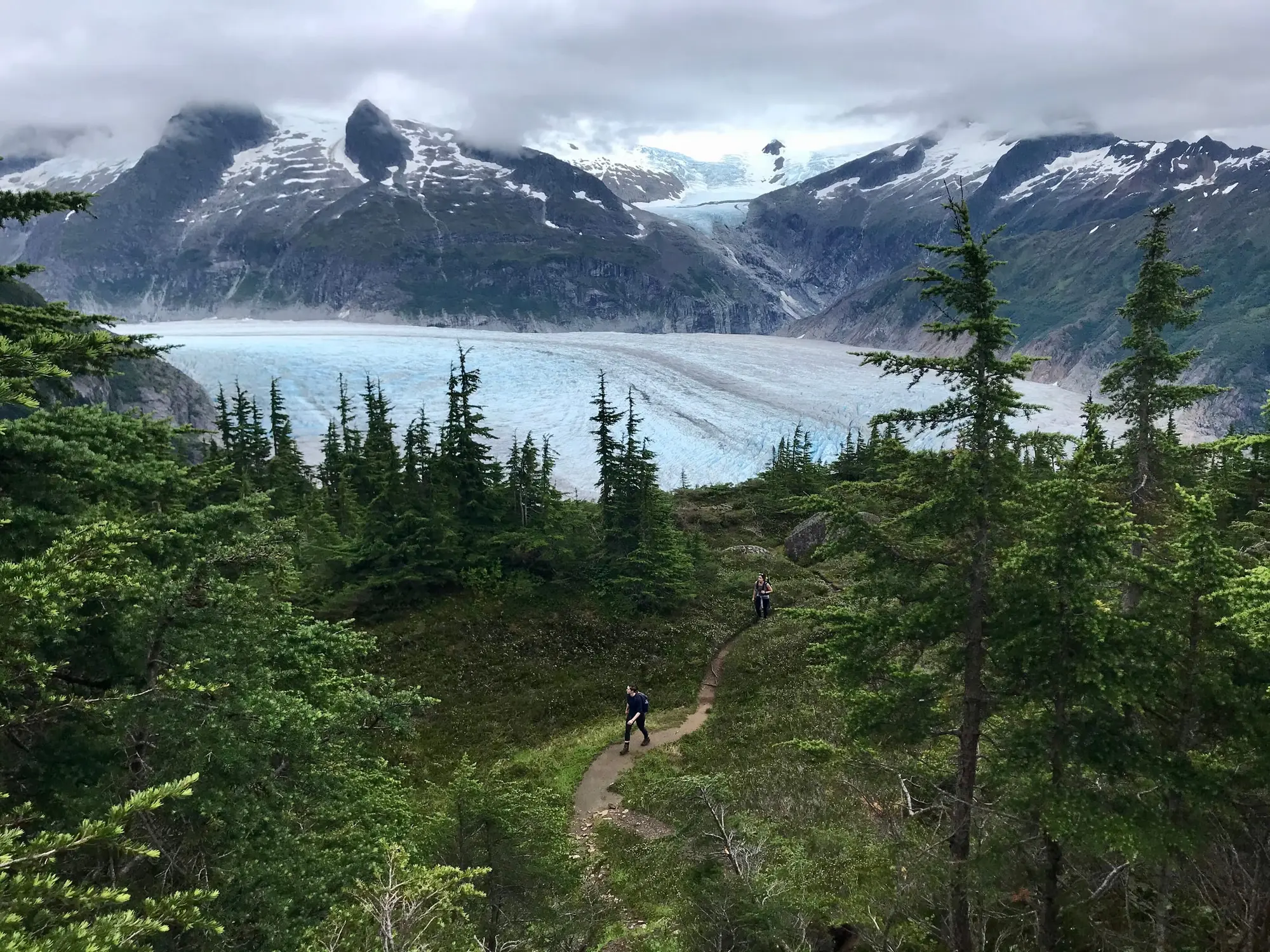

The hikes on this page start in three places: downtown, where the Perseverance Trail is a walk from the cruise docks; Douglas, across Gastineau Channel, where the Treadwell Mine Historic Trail passes the ruins of a gold mine; and the Mendenhall Glacier, about 13 miles out, where the Forest Service’s West Glacier, East Glacier and Nugget Falls trails start. This page is for both of our readers: the cruise passenger with a free half-day in port, and the independent traveler with a car and a few days.
On a port day, Perseverance is the trail here you can reach on foot: its trailhead on Basin Road is about 1.4 miles from the Goldbelt Tram’s base station by the cruise docks. Treadwell is about 4 miles away by car, taxi or city bus, and the glacier trails take a shuttle, a bus or a car. Whichever you choose, our margin is to be back at your dock an hour before the all-aboard time in your ship’s daily program. The walk from each dock is on our Juneau cruise port page.
The Mount Roberts Trail is on our page for the Goldbelt Tram and Mount Roberts, with the tram’s own status. The glacier’s other trails, Photo Point and Steep Creek, the visitor center and Suicide Basin are on our Mendenhall Glacier page.
Which trail fits your time
| Trail | Run by | Where it starts | From the cruise docks | How far |
|---|---|---|---|---|
| Perseverance Trail | City and Borough of Juneau | Basin Road, downtown | About 1.4 miles on foot, uphill, from the Goldbelt Tram’s base (about 1.1 miles more from the A.J. Dock) | The Gold Creek bridge is at mile 2.5 |
| Treadwell Mine Historic Trail | City and Borough of Juneau | Savikko Park (Sandy Beach), Douglas | About 4 miles by road, or Capital Transit’s Route 1 | Walks through the mine ruins in the park |
| Nugget Falls Trail | Forest Service | Halfway along the Photo Point Trail, by the visitor center | About 13 miles | 0.8 miles to the falls |
| East Glacier Trail | Forest Service | The Trail of Time, behind the visitor center | About 13 miles | 2.8 miles, a loop out and back from the Trail of Time |
| West Glacier Trail | Forest Service | The end of Skater’s Cabin Road, on the west side of Mendenhall Lake | A drive past the lake’s campground | 3.5 miles each way to an outcrop over the glacier |
Perseverance Trail, from downtown
The City and Borough of Juneau lists Perseverance among its downtown trails, with the Flume, and it is the trail on this page a cruise passenger can walk to. Its trailhead on Basin Road is about 1.4 miles from the Goldbelt Tram’s base station at 490 S. Franklin Street, by Gold Street and Basin Road: about 30 minutes at a level walking pace, and longer, because the way climbs. By car or taxi it is about 1.5 miles from the Cruise Ship Terminal, some five minutes without traffic.
CBJ counts the trail’s Gold Creek bridge as mile 2.5. In a notice of 31 May 2024 it closed the trail from the Granite Creek intersection to the upper Red Mill junction, from 3 June, while crews from Trail Mix, the trail organization Juneau volunteers founded in 1993, replaced that bridge; the Red Mill Trail kept Granite Creek Basin and Silverbow Basin within reach. CBJ Parks & Recreation posts work closures like that one in its newsroom, as it did in October 2023 for helicopter lifts of bridge materials, so look there before you set out. On a port day, work it out at the trailhead: from the time left until an hour before all-aboard, take off the walk back to your dock, and turn around when half of what remains is spent.
Treadwell Mine Historic Trail, in Douglas
The Treadwell Mine Historic Trail runs through Savikko Park, which CBJ notes is sometimes called Sandy Beach, at the very end of Douglas Highway on Savikko Road. It is about 4 miles from the Cruise Ship Terminal by road, some eight minutes without traffic, and Capital Transit’s Route 1 runs from the Downtown Transit Center to Douglas, to the end of the line it calls Treadwell; how to ride is on our getting around Juneau page. The park has public restrooms, a drinking fountain, a parking lot and the beach itself, with two fire pits.
CBJ gives two sets of hours: 5 a.m. to 10 p.m. on its Savikko Park page, and 7 a.m. to midnight on its page for the trail. Between 7 a.m. and 10 p.m., Alaska time, both have you covered.
What you walk among is the Treadwell complex, four gold mines on Douglas Island. From 1911 to 1917 it was the largest operating hard-rock gold mine in the world, by CBJ’s 2018 plan for the site: over 2,000 people worked its mines, and about $67 million in gold came out of them between 1883 and 1917. On 21 April 1917 a cave-in at sea level flooded three of the mines, and only the Ready Bullion kept working, for five more years. Fires have since taken many of the wooden buildings, and what stands now is mostly concrete foundations and walls, grown over with cottonwood, alder, willow, moss and ferns, with interpretive signs along the way. Two stops matter most: the Glory Hole, the first mine, an open pit now filled with water that you see from an overlook, and the hole the 1917 cave-in left, with its own overlook on the trail. The pilings of the old wharf still stand on the shore. The Treadwell Historic Preservation and Restoration Society, a nonprofit formed in 2008, looks after the site with CBJ.
A guided walk through the ruins is on our salmon bake and gold mine tours page.
The glacier trails: Nugget Falls, East Glacier and West Glacier
All three are the Forest Service’s, in the Mendenhall Glacier Recreation Area of the Tongass National Forest, about 13 miles from the cruise docks: the Forest Service gives 13 miles from the docks on one page and 12 from downtown on another, and the drive takes about 21 minutes without traffic. The shuttles, the city bus and the combos that get you there from the ship are compared on our Mendenhall Glacier tours page.
None of the three needs the Forest Service’s pass. Its fees page (last updated 21 July 2025) lists the Nugget Falls and East Glacier trails, the Trail of Time and every trail in the West Glacier area among the places that need none, and its visitor center page (2 November 2026) names the first three the same way. On 20 November 2026 the Tongass National Forest’s alerts list posted no closure on any of them; its only Juneau Ranger District entries were standing use rules for the Auke and Lena Beach recreation areas, Skater’s Cabin and two campgrounds.
Nugget Falls Trail
The shortest of the three runs 0.8 miles from halfway along the Photo Point Trail to Nugget Falls, skirting the flats at the edge of Mendenhall Lake. It is a low, gentle trail, built in 2010 on a line that keeps its tread above the lake’s high water, and open to hikers, not bikes. The Forest Service lists it for cross-country skiing and snowshoeing as well, and its visitor center page counts keeping the sidewalks and the Nugget Falls Trail plowed all winter among the things its fees pay for.
East Glacier Trail
The East Glacier Trail is 2.8 miles, a loop out and back from the Trail of Time, which starts on the stairs behind the visitor center: take the second left just past a small kettle pond (the first goes to a scenic overlook). It looks at the glacier from a safe distance. Its lower part runs through dense young willow, alder and cottonwood below the glacier’s trimline, and at 1.3 miles a short side trail leads to the A-J waterfall. It also leads on to the Nugget Creek Trail. Hikers and mountain bikers share it.
West Glacier Trail
The West Glacier Trail is the long one: 3.5 miles each way, from the end of Skater’s Cabin Road, past the Mendenhall Lake campground on the lake’s west side, to the junction of the Mt. McGinnis Route. It ends on top of a rock outcrop overlooking the Mendenhall Glacier. Most of the way is below the trimline, in willow, cottonwood and alder, with stretches along the older Sitka spruce and western hemlock forest that the glacier has not reached in recent times. The last section can be hard to follow, so watch for the cairns. Beyond it, a primitive route climbs to the summit of Mt. McGinnis. Hikers and mountain bikers share it.
The trailhead is a paved lot for 49 cars and 6 large buses, and the Forest Service’s hub for raft trips down the Mendenhall River, canoe and kayak trips on the lake, bike tours and guided hikes (the paddling trips are on our kayak and canoe tours page). It has no restrooms and no drinking water.
Stay on the trail. Hiking off the West Glacier Trail leads to 10 to 12 search and rescue efforts a year, three in four of them involving injuries. The Forest Service does not recommend leaving it to reach the glacier: the ground is extremely rough and hazardous, and the trip takes back-country experience, very good fitness and several hours there and back. Never try to go around the rock peninsula back to the trail, over 2 miles of thick brush and deep rock crevices; come back the way you went.
Suicide Basin released twice in 2026, by NWS Juneau’s count: from 11 to 13 August, by CBJ’s report of the basin overtopping on 11 August and NOAA’s forecast crest on 13 August, and on 2 October. The Forest Service’s closure for the August flood came first and ran longer, from 7 to 31 August 2026, the visitor center, Skater’s Cabin and the Mendenhall Lake Campground among it. The state of the basin is on our Mendenhall Glacier page.
Bears, water and winter
Juneau is bear country, and CBJ reminds hikers that bears use its trails and roads. On the trail, make noise where you cannot see or hear far ahead, keep your group close together, leave the headphones and earbuds out, slow down along streams and at blind corners, never approach a bear, and leave at once if you smell or see a carcass. At the glacier, the Forest Service tells visitors to be ready to meet black bears.
The Forest Service lists no water on the Nugget Falls, East Glacier or West Glacier trails, so carry your own. What to wear for Juneau’s rain is on our weather and packing page.
In winter and spring, read CBJ’s avalanche advisory before a hike from downtown. Its advisor’s reports for the 2025–26 season put natural avalanches on the Gold Creek paths above the Flume on 3 February 2026, with powder clouds reaching Basin Road, where Perseverance starts, and more along Gold Creek in mid-April; CBJ says the Gold Creek and Thane paths have large avalanches much more often than Mt. Juneau’s urban paths. On 20 November 2026 the advisory stood at “Normal monitoring”, its last snowpack discussion the one of 5 May 2026 that closed the 2025–26 season. What is open across Juneau this winter is on our Juneau in winter page.
With a guide
Guided hikes at the glacier, with the ride from the docks, are compared on our Mendenhall Glacier hikes and ice caves page, and the guided Treadwell walk is on our salmon bake and gold mine tours page. Everything else Juneau’s operators sell on Viator is in the listing at the end of this page. To fit a hike into a whole day, or three, see our Juneau itinerary.


