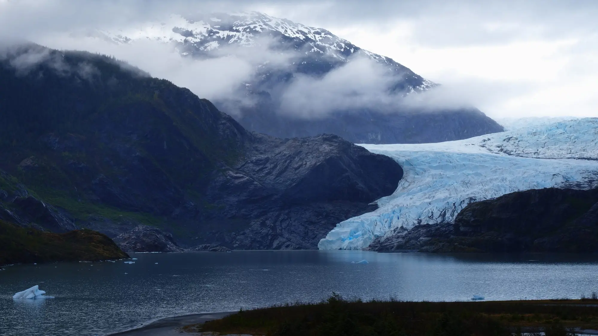
This page is for both of Juneau’s readers: the cruise passenger with a day in port who wants the glacier on their own terms, and the independent traveler with a car, a bus fare or a free afternoon. The Mendenhall Glacier Recreation Area, in the Tongass National Forest, is about 13 miles from the cruise docks. From its visitor center you look across Mendenhall Lake to the ice, which ends on the lake’s far shore: a glacier the Forest Service puts at thirteen miles long, one of many glaciers connected to the 1,500-square-mile Juneau Ice Field.
Below: the visitor center’s state this winter and its hours, what the $5 fee covers and what it does not, the trails from Photo Point to Nugget Falls and along both sides of the lake, how to get there without a tour, and the floods from Suicide Basin that closed part of the area in August 2026. For the shuttles and tours from the docks, see Mendenhall Glacier tours.
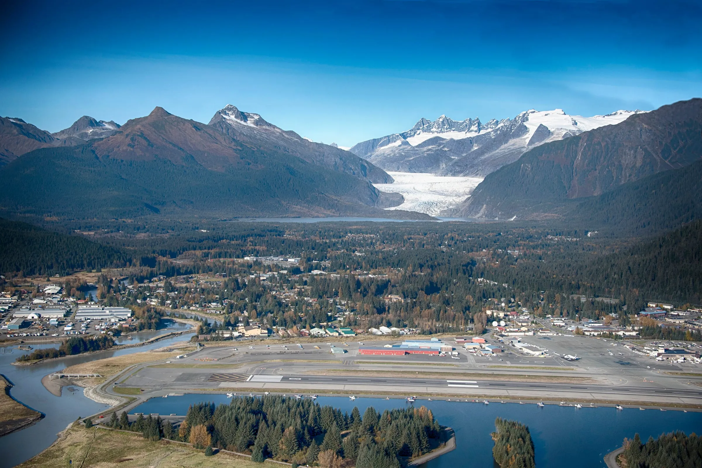
The photograph below shows where the glacier sits: at the head of the Mendenhall Valley, with the airport’s runway in front and the lake at the foot of the ice.
The visitor center this winter, and its hours
The Forest Service’s page for the Mendenhall Glacier Visitor Center, last updated on 2 November 2026, says the center is under construction and closed for the winter of 2026–2027, with no reopening date given. It still said so when we read it on 20 November 2026. The grounds around the center are open from 6 a.m. to midnight, Alaska time, all year.
A second Forest Service page, the center’s recreation page, last updated on 25 September 2026, still gave winter hours on 20 November: 10 a.m. to 4 p.m., Alaska time, on Fridays and Saturdays from November to March, except federal holidays, and open now and then in April and October. The 2 November page is the later of the two, and it is the one to plan by: the center is shut this winter.
In summer both pages give 9 a.m. to 6 p.m. AKDT, seven days a week, from May to September; the recreation page calls those “the 2026 summer months”. Neither gave hours or an opening date for 2027 when we read them. What else in Juneau is open this winter is on our Juneau in winter page.
When it is open, the center is reached from its parking lots by stairs, elevators and an easy ramp. Forest Service rangers staff it, with exhibits, a 15-minute film and the Discovery Southeast bookstore. Built in 1962, it was the first visitor center in the National Forest System.
The fee, and where you need a pass
From 1 May to 30 September the Forest Service charges $5 a person a day, or $15 for a season pass that covers its holder and one guest; visitors 15 and under are free. That season is the one both visitor center pages give (2 November and 25 September 2026). The Forest’s fees page, last updated on 21 July 2025, gives the same $5 and $15 with no season.
From 16 years old you need the pass for:
- the visitor center;
- the Photo Point Trail;
- Steep Creek;
- the pavilion;
- the restrooms and the bus shelter.
You need none for the parking areas, or for the Nugget Falls, East Glacier, Powerline and Moraine Ecology trails, the Trail of Time, the Dredge Lakes trails or the West Glacier area’s trails. Passes are sold from machines in the parking lots and at the bookstore inside the center. America the Beautiful passes (the annual, senior, access, military and volunteer passes) are honored, and admit the holder and three others.
In 2026 the Forest Service proposed raising the day fee to $15 a person, with a new $20 season pass, and took public comments from 22 May to 20 July, by its proposed recreation fees page (updated 1 July 2026). On 20 November 2026 the Forest’s fees page still gave $5 a day and $15 a season. Which of the tours from the docks include the fee is set out on our Mendenhall Glacier tours page.
The trails
Every figure here is the Forest Service’s. Of the trails, only Photo Point and Steep Creek take the pass in summer; the rest are free all year.
Photo Point and Nugget Falls. The Photo Point Trail runs from the visitor center out to Photo Point, the viewpoint on the lake, where terns nest. The Nugget Falls Trail, 0.8 mile long, begins halfway down the Photo Point Trail, crosses an elevated walkway through a rock gorge and ends at Nugget Falls, skirting the flats at the edge of Mendenhall Lake. It is low gradient, built in 2010 and realigned so its tread sits above the lake’s high water, and you walk back the same way. The Forest’s visitor center page counts keeping the sidewalks and the Nugget Falls Trail plowed all winter among what the fees pay for.
Steep Creek and the Moraine Ecology Trail. The paved Steep Creek Trail loops through the visitor center’s first and second parking lots. The fees pay for live cameras on the terns’ nesting area at Photo Point and the salmon spawning in Steep Creek, and the Forest Service lists sockeye and coho salmon, black bears, porcupines, beavers and bald eagles among the wildlife to be prepared to meet here. The Moraine Ecology Trail leaves the Steep Creek Trail in a sandy area, marked with “ME” signs, past kettle ponds, where the Forest says to look for ducks and loons, to the silty beach of Mendenhall Lake and its view of the glacier.
The Trail of Time and the East Glacier Trail. The Trail of Time begins on the stairs behind the visitor center. The East Glacier Trail, 2.8 miles, loops out and back from it: take the second left past a small kettle pond, since the first left goes to a scenic overlook. It gives excellent views of the glacier from a safe distance, through dense willow, alder and cottonwood on its lower part, and a short side trail reaches the A-J waterfall 1.3 miles from the trailhead. It is open to hikers and mountain bikes, and leads on to the Nugget Creek Trail.
The West Glacier Trail. On the far side of the lake, the West Glacier Trail starts from its own trailhead at the end of Skater’s Cabin Road, past the Mendenhall Lake Campground: a paved lot for 49 cars and 6 large buses, with no restrooms and no drinking water. The trail runs 3.5 miles, mostly below the glacier’s trimline, to a rock outcrop overlooking the glacier, where a primitive route goes on to the summit of Mt. McGinnis. Its last section can be hard to follow; cairns mark the way. The same trailhead is the hub for raft trips down the Mendenhall River and canoe and kayak trips on the lake.
Stay on the trail. Hiking off the West Glacier Trail leads to 10 to 12 search and rescue efforts a year, three quarters of them involving injuries, by the Forest Service’s count. The ground between the trail and the glacier is extremely rough and hazardous; the Forest does not recommend crossing it, and says it takes back-country experience, very good fitness and several hours for the round trip. To stand on the ice, go with a guide. The Forest’s list of companies permitted to guide in the recreation area (last updated on 20 March 2025) names two for glacier treks and ice caves, which they enter only if conditions allow, and three helicopter companies for the icefield beyond. Our ice cave and glacier hikes and helicopter glacier tours pages compare them, and our canoe and kayak tours page the trips on the lake.
Juneau’s trails beyond the glacier, from Perseverance to Treadwell, are on our Juneau hiking trails page.
Getting there
From the cruise docks. The visitor center is about 13 miles from downtown and the cruise docks, by the Forest Service’s count; its recreation page gives 12 miles from downtown. By car from the Cruise Ship Terminal it is 12.8 miles on OpenStreetMap’s roads, about 21 minutes with no traffic. Two private companies, Juneau Tours and M&M Tours, run shuttle buses between the docks and the glacier, the Forest Service says, and Capital Transit puts the private buses at about 30 minutes from downtown. Our Mendenhall Glacier tours page sets both shuttles, and the glacier-and-whale combos, against your hours in port. Juneau’s taxis make the trip too.
By city bus. Capital Transit has no stop at the visitor center. Its routes 3 and 4, the Mendenhall Valley loops, and route 8, the express, run from the Downtown Transit Center to Dredge Lake Road, the closest stop, 1.5 miles from the center. The ride can take up to an hour, and Capital Transit puts the whole trip at up to 1.5 hours each way, walk included. From the stop you follow a flat, paved, wheelchair-accessible bike path, which Capital Transit puts at about 1.5 miles and 30 minutes; on OpenStreetMap’s paths it measures 1.75 miles, nearer 40 minutes at a steady pace. There are no restrooms on the walk. Some cruise terminals are up to 1.5 miles from the Transit Center, which can add 30 minutes or more each way.
Since the week of 29 September 2026, route 8, the fastest, has run Monday to Friday only; on a weekend take route 3 or 4. Since 5 October Sunday buses start later and stop earlier: on a Sunday the last bus back to downtown, route 4, leaves the Dredge Lake Road stop (stop 469) at about 5:31 p.m. and the Valley Transit Center at 5:45 p.m., Alaska time. The fare is $2 for an adult (19 and older, seniors included), $1 for ages 6 to 18 and free for 5 and under, sales tax included, paid in exact cash, since drivers give no change, or with the Token Transit app.
From the airport or the ferry. The center is 5 miles from Juneau International Airport and 7 from the Alaska Marine Highway System’s terminal at Auke Bay, by the Forest Service’s directions: about 10 and 13 minutes’ drive with no traffic. Capital Transit’s airport route, the 6, has been suspended for staffing since 20 April 2026 (its fall service page listed it as temporarily suspended from 5 October, and still did on 20 November 2026); airport riders are sent to routes 3 and 4 at the stops on Glacier Highway near Shell Simmons Drive. Car rental at the airport and the other ways around town are on our getting around Juneau page.
Back to the ship. If you go out on your own, by bus or taxi, be back at the dock an hour before all-aboard. That is our margin, not the ship’s rule: all-aboard is the time in your ship’s daily program, and it comes before the sailing time on the port’s calendar. The docks and the walks between them are on our Juneau cruise port page.
Suicide Basin and the floods
Suicide Basin, on the Mendenhall Glacier, fills with water and lets it go in glacial lake outburst floods, which flood Mendenhall Lake and the Mendenhall River below. In 2026 it did so twice.
August 2026. On 7 August the Forest Service signed an emergency order closing the Mendenhall Lake Closure Area, among it the Mendenhall Campground, Skaters Cabin, the visitor center and the Dredge Lakes area, to remain in effect until 31 August (Forest Order 10-05-33-26-11). On 11 August the City and Borough of Juneau (CBJ) reported that the Weather Service’s monitoring showed the basin full and beginning to overtop. NOAA’s incident report for the flood, opened that day, said the basin was releasing, forecast a crest of 16.1 to 16.6 feet, in major flood stage, between 5 and 9 a.m. AKDT on 13 August, and said that about 1,900 residences in the inundation area were advised to evacuate on 12 August. CBJ asked everyone else to keep out of the evacuation advisory area. The order’s dates and the flood’s differ: the closure came first, on 7 August, and was set to outlast the 11 to 13 August flood by more than two weeks.
2 October 2026. The National Weather Service’s Suicide Basin page, last updated on 13 October 2026, says the basin released a second time on 2 October and Mendenhall Lake crested at 10.18 feet, just above the moderate flood stage of 10 feet. It expected no other significant release this year, as colder weather limits what flows into the basin, and the USGS monitoring equipment is shut down for the season, to be turned back on in the spring of 2027.
August 2025. The year before, the Forest Service’s order of 12 August 2025, set to run to 20 August and replacing one of 11 August, closed the campground, Skaters Cabin, the visitor center and Glacier Spur Road, the road to the center.
These orders bind the tours too: a permit for outfitting, guiding or transporting does not exempt its holder. On 20 November 2026 the Tongass National Forest’s alerts list showed no closure at Mendenhall. Before a late-summer visit, read the Weather Service’s Suicide Basin page and the Tongass alerts on the day.
The glacier’s names
The glacier and its valley are in the ancestral homelands of the Aak’w Kwáan. The Central Council of the Tlingit & Haida Indian Tribes of Alaska gives the glacier two Lingít names and says both are correct: Áakʼw Tʼáak Sít’, “The Glacier Upland from Áakʼw”, and Sít’ Aant’aakú, “The Glacier Behind Town”. In September 2023 Tlingit & Haida, as the Central Council calls itself, signed an agreement with the U.S. Department of Agriculture, which runs the Forest Service, for co-stewardship of the recreation area, giving it a share in decisions there; its Cultural Ambassador program, launched in 2024, placed tribal citizens at the glacier to share Lingít culture with visitors. Sealaska Heritage Institute and the Alaska State Museum are on our Juneau museums and Tlingit culture page.